Aerial photography and drone documentation for buildings, master plans, development sites, and large-scale infrastructure. Operated under full permits across the UAE and KSA. Precision-planned to capture scale, context, and the relationship between architecture and landscape that no ground-level lens can achieve.
Developers and master planners who need the full scope of a project communicated — site context, phase completion, scale relative to surroundings. Architects whose buildings require aerial perspective to read correctly. Government and institutional clients documenting infrastructure and cultural projects at a national scale.
Past clients include KAFD, RCU, and NEOM. Projects have ranged from individual residential plots to multi-kilometre master plan documentation.
All aerial work in the UAE is operated in full compliance with GCAA regulations. Permits are obtained and managed as part of the commission — no additional administrative burden on the client. KSA operations are similarly managed under the relevant GACA framework.
For sensitive sites — government buildings, restricted zones, proximity to airports — the permit process begins at least two weeks before the shoot. This timeline is factored into the project schedule from the first conversation.
What Is Aerial Photography?
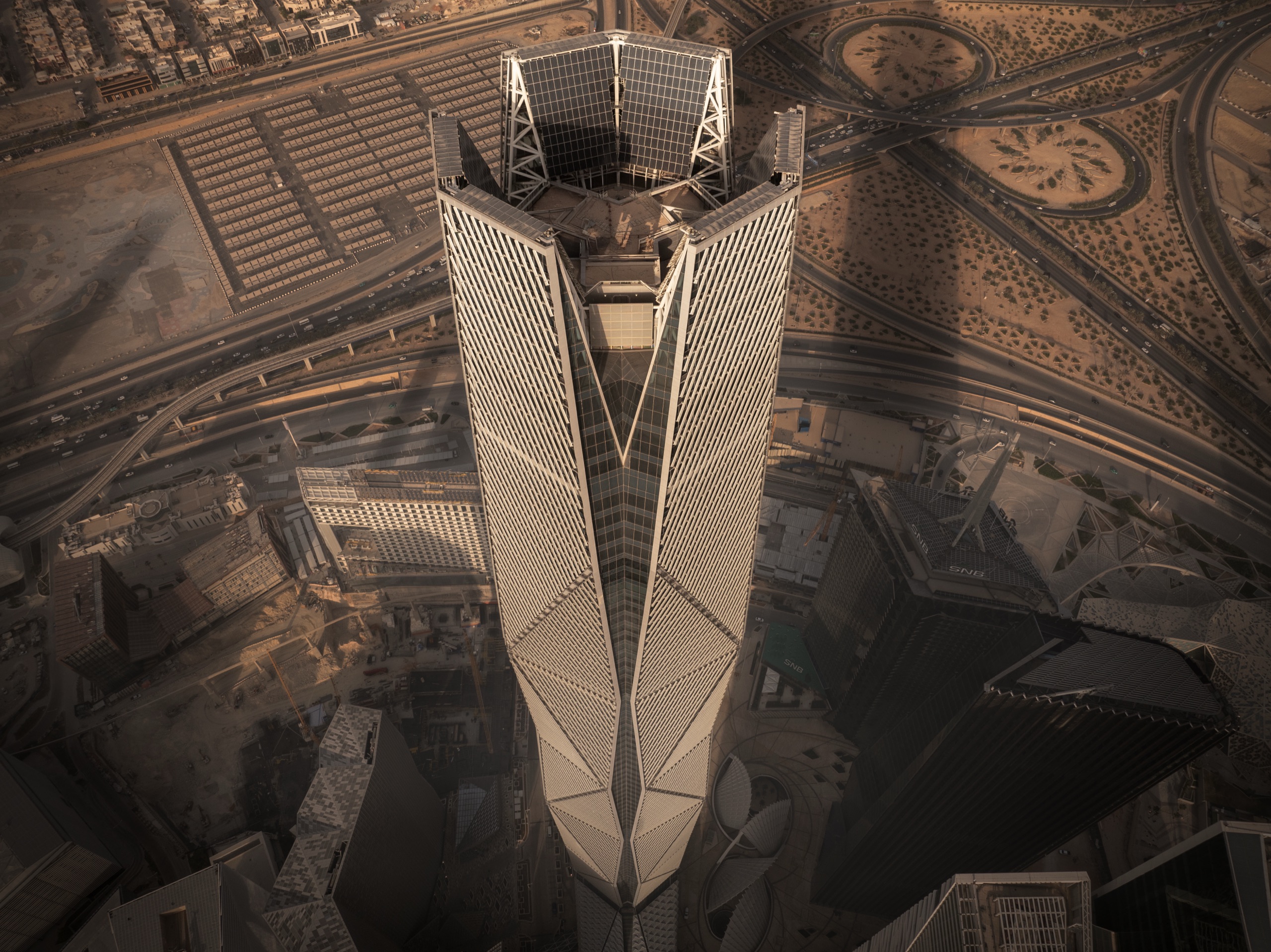
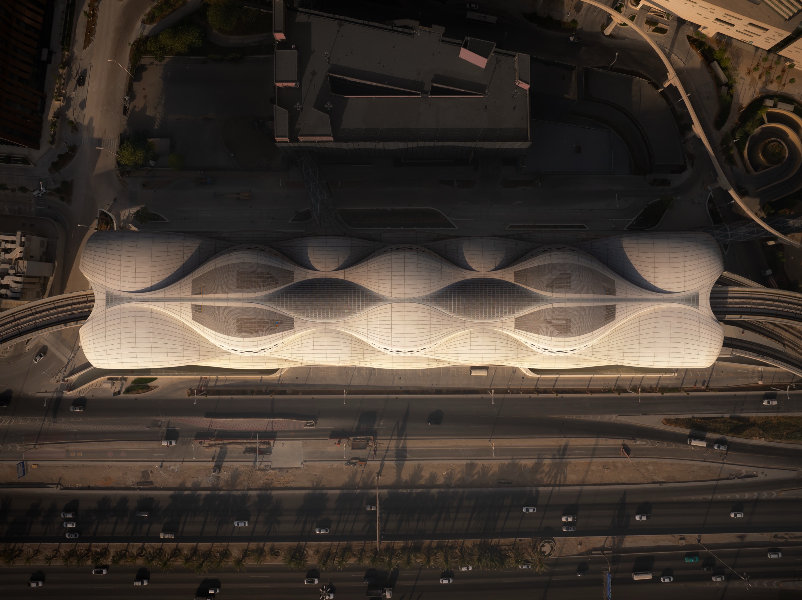
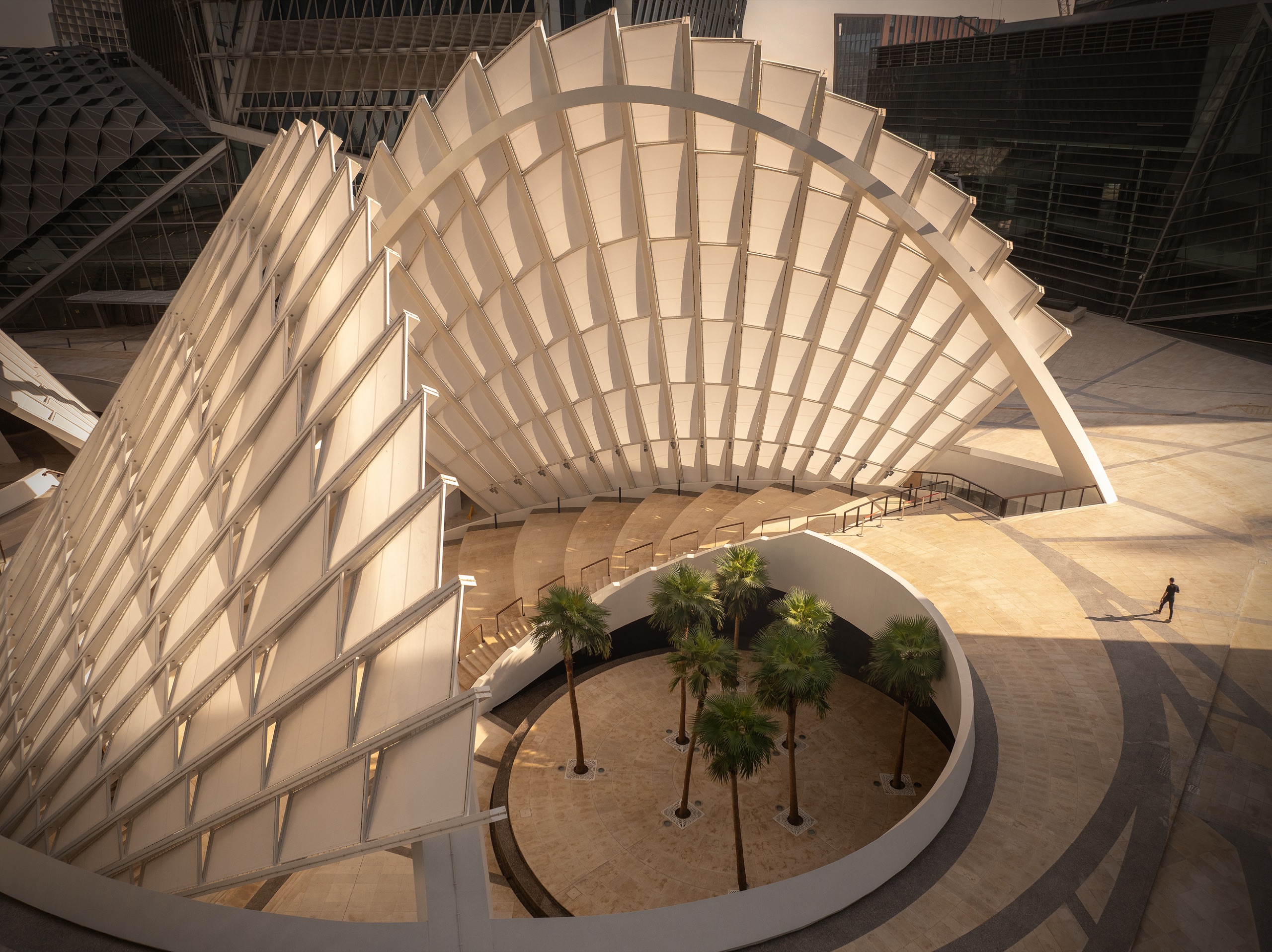
Aerial photography uses permitted drone flight to show a building, site, or development the way no ground-level lens can: its scale, its context, and the relationship between the architecture and the landscape around it. For a tower it reveals the skyline it joins; for a master plan it shows the whole scheme at once; for a cultural project it places the building in its setting.
Done at this level it is architectural work made from the air, planned around light and composition with the same considered eye, not a quick flyover. It is built for marketing, master-plan documentation, and award and publication use. Every flight is flown as a licensed drone operator, permitted and planned.
Who Needs an Aerial & Drone Photographer?
Developers and master planners communicating site context, phase completion, and scale. Architects whose buildings only read correctly from above. Government and institutional clients documenting infrastructure and cultural projects at national scale. Marketing teams that need the location and setting to be part of the story.
Leading Aerial Photographer in Dubai, Riyadh, and the Middle East
Aerial commissions across the UAE and KSA include KAFD in Riyadh, AlUla Airport, NEOM in the Tabuk region, and House of Wisdom in Sharjah, for clients including RCU and NEOM. The year-long aerial and architectural documentation of KAFD took 1st Place in Cityscapes at the International Photography Awards 2025. All operations run under full GCAA (UAE) and GACA (KSA) permits, and the work carries more than 60 international awards.
Types of Aerial Photography
Towers & Buildings
Single buildings shot from the air to show form, height, and the skyline they sit within.
Master Plans & Sites
Whole developments and multi-kilometre schemes captured to communicate scope and phase.
Cultural & Infrastructure
Airports, museums, and civic and infrastructure projects documented at national scale.
Cityscape & Context
Urban and skyline work showing how a project relates to the city around it.
Construction & Progress
Phase and completion documentation for developers and contractors over a project's life.
Aerial Film
Cinematic drone motion for launch films and brand campaigns, alongside stills.
How an Aerial Shoot Works
Every aerial commission begins with the permit and the plan. UAE work runs under GCAA approval and KSA work under GACA, obtained and managed as part of the commission, with sensitive sites (government buildings, restricted zones, airport vicinities) started at least two weeks ahead. The flight is planned around the light and the angles that make the project read.
Capture is high-resolution for large-scale print and publication, with fine-art realistic retouching to match the rest of the project's imagery. Delivery is organised and sized for marketing, master-plan documents, and awards.
Aerial Photography by City
Aerial and drone commissions run across the UAE, Saudi Arabia, and the wider Gulf, from working bases in Dubai and Riyadh, with clearance arranged per site. Explore aerial photography by location: Dubai, Riyadh, Abu Dhabi, Sharjah, Jeddah, Doha, Muscat, Dammam, AlUla, NEOM.